
What Does “Fixed” vs “Float” Mean in RTK?
If you use a GNSS rover for surveying, mapping, stakeout, construction layout, or machine control, you have probably seen status messages like Single, DGNSS, Float, and Fixed. These RTK status indicators are not just labels on a data collector screen. They tell you whether your rover is working with basic positioning, corrected positioning, or a high confidence RTK solution that is ready for precise survey work.
The two statuses surveyors care about most are RTK Float and RTK Fixed. A float solution can sometimes look close, but it is not the same as a fixed solution. Understanding the difference can help you avoid bad shots, poor stakeout results, rework, and confusing coordinate shifts in the field.
Quick Answer: Fixed vs Float in RTK
In simple field terms, RTK Fixed means the rover has a strong enough satellite geometry, correction stream, and signal quality to calculate a precise position with high confidence. This is the status most surveyors want before collecting important topo shots, control points, stakeout points, or boundary related observations.
RTK Float means the rover is receiving correction data, but it has not fully resolved the carrier phase ambiguities. The rover is trying to calculate a corrected position, but the solution is still uncertain compared to a fixed solution.
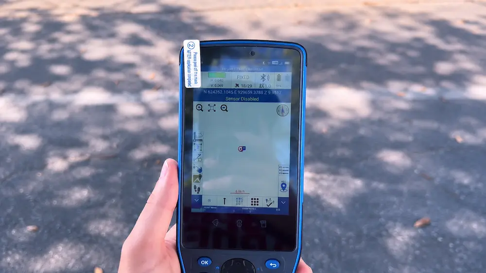
This is a Stonex data collector showing a fixed RTK solution unerneath a bunch of trees as seen with the shadows. This was shot at our SiteSurv Dania Beach Location by our mascot Ego The Surveyor.
What Is RTK in Surveying?
RTK stands for Real Time Kinematic. It is a GNSS positioning method that uses satellite signals plus correction data from a base station or RTK network. The rover compares its own satellite observations against correction data from the base or network to reduce common GNSS errors in real time.
A basic standalone GNSS receiver can usually get you in the general area, but that is not enough for professional surveying. RTK improves positioning by using correction data and carrier phase measurements to produce much tighter horizontal and vertical results.
In a typical RTK setup, you have:
- A rover: The GNSS receiver you carry in the field.
- A base station or network: The known reference source sending correction data.
- A correction link: Radio, cellular, NTRIP, internet, or another communication method.
- A data collector: The controller or software showing your RTK status, accuracy estimates, correction age, satellites, and measurement settings.
The goal is to reach a stable fixed solution before collecting high precision measurements.
Common RTK Statuses Explained
Different brands and software platforms may use slightly different labels, but most GNSS receivers show similar RTK status levels. Understanding these statuses helps you know when the rover is ready and when you need to troubleshoot.
| Status | What It Usually Means | Typical Field Use | Confidence Level |
|---|---|---|---|
| Single | The receiver is calculating a standalone GNSS position without RTK corrections. | General location only. Not suitable for precise survey shots. | Low for survey work |
| DGNSS or DGPS | The receiver is receiving some correction data, often code based corrections, but not a full fixed RTK solution. | Better than standalone GNSS, but usually not enough for high precision survey layout or control. | Medium |
| RTK Float | The rover is receiving RTK corrections, but the carrier phase ambiguities are not fully fixed. | Useful for searching, rough topo, or waiting for a fix. Use caution before storing critical points. | Medium to questionable depending on conditions |
| RTK Fixed | The rover has resolved the ambiguities and is producing a high confidence RTK position. | Preferred status for precise survey shots, stakeout, control, and layout. | High when stable and checked properly |
What Does RTK Float Mean?
RTK Float means the rover is receiving correction data, but the RTK engine has not fully resolved the carrier phase ambiguities into a fixed integer solution. In plain English, the rover is close, but it has not fully locked in.
A float solution may happen when:
- The rover is under trees, next to buildings, near vehicles, or close to reflective surfaces.
- The satellite geometry is weak.
- The correction stream is delayed or dropping.
- The base station is too far away.
- The rover is not tracking enough clean satellites.
- The antenna height, setup, or configuration is incorrect.
- The job is in a high multipath environment.
Float is not automatically wrong, but it is not the same as fixed. A float shot can sometimes be off by a few centimeters, several tenths, or more depending on field conditions. The dangerous part is that a float solution may appear stable for a short time even though it is not reliable enough for the kind of work you are doing.
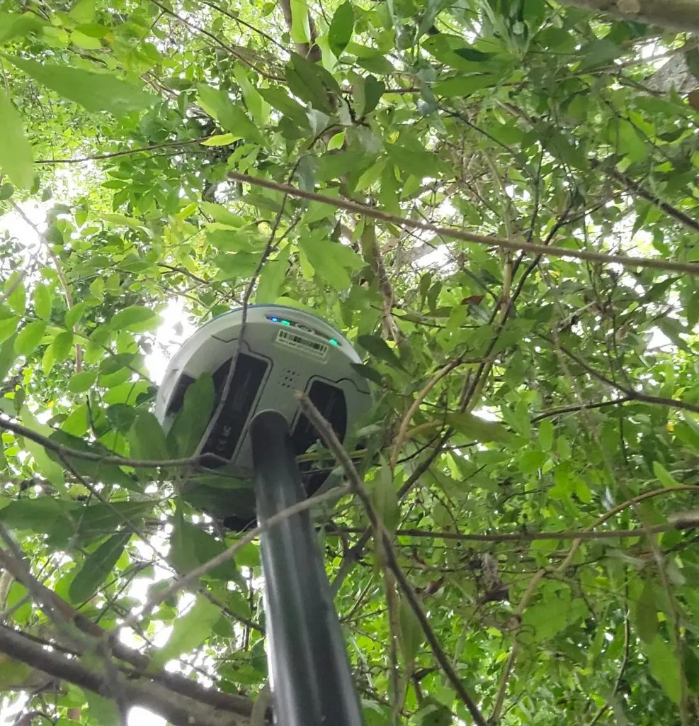
Even under canopy the Stonex GPS we sell at SiteSurv still gives fixed readings. Thanks Frankie for the photo!
What Does RTK Fixed Mean?
RTK Fixed means the receiver has resolved the carrier phase ambiguities and is producing a precise RTK position. This is the status surveyors normally want before collecting important points.
When your rover is fixed, it usually means:
- The rover is receiving usable correction data.
- The satellite signals are strong enough for the RTK engine.
- The correction age is acceptable.
- The rover has enough clean satellite observations.
- The receiver has resolved the carrier phase ambiguities.
- The horizontal and vertical precision estimates are within your project tolerance.
However, fixed does not mean impossible to be wrong. A bad base coordinate, wrong rod height, wrong projection, multipath, incorrect localization, or false fix can still create bad data. That is why professional survey workflows still rely on checks, repeated observations, known points, and good field procedures.
Fixed vs Float Comparison Table
| Category | RTK Float | RTK Fixed |
|---|---|---|
| Correction Data | Receiving corrections, but the solution is not fully resolved. | Receiving corrections and using them successfully for a resolved RTK solution. |
| Ambiguity Resolution | Carrier phase ambiguities are still floating. | Carrier phase ambiguities have been fixed to integer values. |
| Accuracy Confidence | Lower confidence. Can vary widely depending on conditions. | Higher confidence. Generally preferred for centimeter level RTK work. |
| Best Use | Searching for points, rough navigation, waiting for better conditions, noncritical mapping. | Topo shots, stakeout, layout, control checks, construction work, and other precision tasks. |
| Risk | Can look close but still be outside tolerance. | More reliable, but still requires field checks and proper setup. |
| Field Decision | Use caution. Do not store critical shots unless your procedure allows it and checks confirm it. | Generally acceptable when stable, repeatable, and within tolerance. |
Why Your Rover Stays in Float
If your rover will not go fixed, the issue usually falls into one of four categories: satellite environment, correction link, base/network setup, or field configuration.
1. Poor Sky View
RTK needs clean satellite signals. Heavy tree canopy, tall buildings, bridges, vehicles, metal fences, and nearby equipment can block or reflect GNSS signals. This is one of the most common reasons a rover stays in float.
2. Multipath
Multipath happens when satellite signals bounce off surfaces before reaching the antenna. This can confuse the receiver and make it difficult to resolve a fixed solution. Common multipath sources include buildings, trucks, water, metal roofs, chain link fences, and nearby machinery.
3. Correction Data Problems
Your rover may be connected to the base or NTRIP caster, but the correction data may be delayed, weak, mismatched, or dropping. Check your correction age, radio signal, cellular strength, mountpoint, and data stream format.
4. Long Baseline
The farther the rover is from the base station, the harder it can be to maintain reliable RTK performance. Long baselines can make atmospheric differences more difficult to model and may increase the chances of float or unreliable results.
5. Wrong Mountpoint or Correction Format
If you are using an RTK network, make sure you are connected to the correct mountpoint for your receiver, region, and correction needs. If the correction format or network settings do not match your equipment, your rover may struggle to fix.
6. Bad Base Setup
If you are using your own base, a wrong base coordinate, bad antenna height, unstable tripod, incorrect base mode, or poor base location can create problems for every rover shot you collect.
7. Receiver Settings or Job Settings Are Wrong
Incorrect coordinate systems, geoid models, antenna models, elevation masks, or data collector settings can cause bad results even if the rover says fixed. Always verify the job setup before collecting production data.
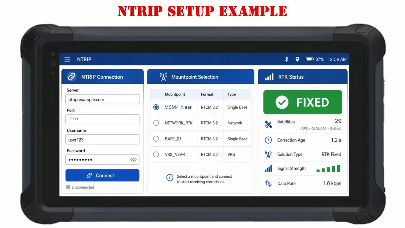
One of the data collectors we offer at SiteSurv showing some simple example settings for NTRIP.
What Does Correction Age Mean?
Many data collectors show an age value or correction age. This tells you how long it has been since the rover received the latest correction message.
In the field, a lower correction age is usually better. If the age value keeps climbing, your rover may be losing correction data. If the correction age is too old, the rover may drop from fixed to float, or your measurements may become unreliable.
A practical rule of thumb:
- Cellular or NTRIP corrections: Around 1 to 2 seconds is commonly expected in a healthy connection.
- Radio corrections: Around 2 to 4 seconds may be normal depending on the radio setup and equipment.
- Correction age climbing higher: Investigate the radio link, cellular connection, base, mountpoint, or data stream.
RTK Fixed Solution Field Checklist
Before storing important RTK observations, use this checklist to reduce the chance of bad measurements.
- Confirm the rover status is RTK Fixed.
- Check that correction age is low and stable.
- Verify the horizontal and vertical precision estimates are within project tolerance.
- Confirm the rod height is correct before storing the shot.
- Check that the correct antenna model is selected.
- Confirm the correct coordinate system, geoid, and job settings are being used.
- Observe under the clearest sky view possible.
- Watch for multipath from buildings, vehicles, fences, water, or metal surfaces.
- Take check shots on known control before collecting production data.
- Reobserve important points after reinitializing or after a time separation when needed.
- Do not rely on one quick fixed shot for critical control without verification.
- Document field conditions when working in difficult environments.
When You Should Not Store the Shot
There are times when the best survey decision is to wait, move, or use another method. Do not store important RTK shots just because you are close to the point.
Be careful when:
- The rover is in float and will not fix.
- The correction age is climbing or unstable.
- The horizontal or vertical precision estimate is outside tolerance.
- The rover keeps switching between fixed and float.
- You are under tree canopy or near a reflective structure.
- The point does not check against known control.
- Your rod height or antenna setup may be wrong.
- You are not sure the base coordinate or network mountpoint is correct.
Best Practices for Reliable RTK Measurements
Start on Known Control When Possible
Before collecting new points, check into a known point. This helps confirm that your coordinate system, localization, base setup, correction stream, and rod height are working together correctly.
Let the Rover Settle
When you first connect, the receiver may show single, DGNSS, float, and then fixed. Give the rover time to initialize instead of storing the first position you see.
Watch the Environment
RTK is highly sensitive to satellite visibility and signal quality. If you cannot get fixed near a tree, vehicle, or building, move into a better sky view and see whether the rover fixes quickly.
Use Repeated Observations for Important Points
For important points, store more than one observation, reinitialize the receiver, or come back later for a second check. This is especially useful for control points, boundary evidence, and construction layout checks.
Know When to Use a Total Station
RTK is powerful, but it is not the best tool for every environment. Under canopy, near buildings, or in tight urban areas, a robotic total station or conventional total station may produce more reliable results.
FAQs About RTK Fixed and Float
What does fixed mean in RTK?
Fixed means the GNSS rover has resolved the carrier phase ambiguities and is producing a high confidence RTK position. This is typically the preferred status for precise survey work.
What does float mean in RTK?
Float means the rover is receiving RTK corrections, but it has not fully resolved the ambiguities into a fixed solution. It may be closer than standalone GPS, but it is not as reliable as fixed for precision work.
Can I survey with RTK float?
It depends on the work and your required tolerance. Float may be acceptable for rough mapping or searching, but it is generally not recommended for control, boundary, construction layout, or other high precision survey tasks unless your procedure specifically allows it and independent checks confirm the result.
Why does my rover keep switching from fixed to float?
Common causes include tree canopy, buildings, multipath, weak satellite geometry, correction data interruptions, long baseline distance, poor cellular or radio connection, or incorrect receiver settings.
How long should it take for RTK to get fixed?
In good conditions with a clean sky view and a healthy correction stream, many modern receivers can fix quickly. If the rover takes a long time or never fixes, check sky view, correction age, mountpoint, baseline distance, satellite tracking, and job settings.
Is RTK fixed always accurate?
No. Fixed is the best RTK status, but bad base coordinates, wrong rod height, incorrect coordinate system, multipath, false fix, or poor field procedures can still create bad data. Always use check shots and proper survey procedures.
What is correction age in RTK?
Correction age is the amount of time since the rover last received correction data. A low and stable correction age is usually better. If correction age rises or becomes unstable, your rover may drop from fixed to float or produce unreliable positions.
What is the difference between DGNSS and RTK fixed?
DGNSS usually refers to a corrected GNSS solution that is better than standalone positioning but not as precise as a fixed RTK solution. RTK fixed uses carrier phase corrections and resolved ambiguities for higher precision.
Why does my rover say fixed but my point still checks bad?
Possible causes include wrong rod height, incorrect base coordinate, wrong localization, wrong geoid, incorrect antenna model, multipath, false fix, or collecting the point before the solution was stable. Check known control and repeat the observation.
What should I check first when I cannot get a fixed solution?
Start with the basics: move to open sky, check correction age, verify internet or radio connection, confirm the correct mountpoint, check satellite count and PDOP, verify the base setup, and confirm your job settings.
Final Thoughts
Fixed vs float is one of the most important RTK concepts for surveyors to understand. A fixed solution tells you the rover has reached the high confidence RTK status you usually need for precise work. A float solution means the rover is corrected but not fully resolved, which makes it riskier for professional survey measurements.
The best field crews do not just wait for the word “Fixed.” They check correction age, precision estimates, control points, rod height, antenna settings, coordinate systems, and repeatability. That is what separates a quick GNSS shot from reliable survey data.
Need GNSS receivers, RTK accessories, tripods, poles, field supplies, or help choosing the right setup? Visit SiteSurv USA for professional survey equipment and support.